
Pengenffordd Walks
WELCOME TO PENGENFFORDD – GATEWAY TO THE BLACK MOUNTAINS
Pengenffordd is at the top of the pass between the Wye and Usk valleys. In times past it was called Pen-cefn-ffordd (top of the ridge road). Here you can see for yourself the local history of this part of the Welsh Borderlands.
Pengenffordd was on one of the drovers’ roads for moving cattle and sheep from Mid-Wales to the English markets. Its strategic importance is emphasised by Castell Dinas, standing sentinel overlooking the pass. Castell Dinas is the highest castle in Wales at an elevation of 1476 feet. On the other side of the pass stands the prominent ridge of Mynydd Troed.
Castell Dinas was originally an Iron Age hillfort in the period 600 BC to 50 AD. Imagine being stationed here in the depths of winter with the need to bring food and fuel to support the occupants on this windswept top.
After the Norman Conquest the Normans exploited the ramparts to build a fortified stone castle. This was built on the site in the 1070s.
The castle was sacked by Llywelyn the Great in 1233 and subsequently refortified by King Henry III. The castle was again captured by Llywelyn's grandson, Prince Llywelyn ap Gruffud in the 1260s. The castle was finally destroyed in 1404 by the supporters of Owain Glyndwr during the early 15th century rebellion in Wales.
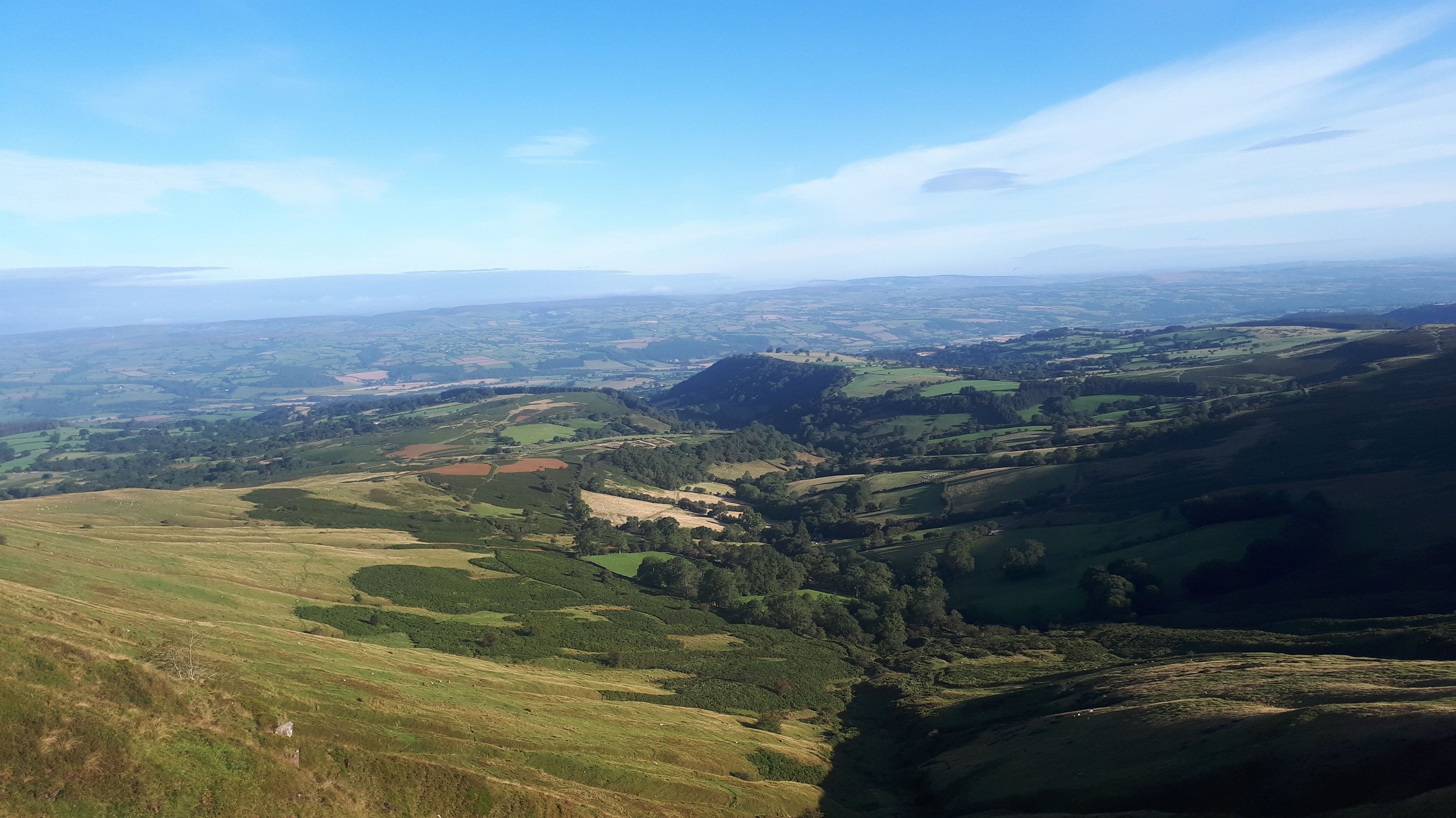
What remains now are parts of a curtain wall, a gatehouse and the outline banks of the inner keep mainly covered with earth. The outlines of ditches and ramparts from the original Iron Age fortifications are also visible. There are commanding views up into the Black Mountains, and across to the Brecon Beacons and the Radnorshire hills.
Castell Dinas forms the western part of the narrow ridge of Y Grib (Dragon’s Back) which leads onto the upper plateau and ridges of the Black Mountains.
Walk 1 - Ascent of Castell Dinas
Starting from Castell Dinas Inn, a direct ascent can be made. Climb down from the car park on to the ancient trackway and turn right. After a few metres, climb a stile to the left and follow the left-hand boundary of the field down to a stream. After crossing the stream, climb steadily alongside a hedge and fence with Castell Dinas ahead of you. Reaching a small wood, the path branches slightly right to the top (430m).
A less challenging ascent is to leave the car park and follow a track alongside the main road. Take the first turn right up a lane to Dinas Farm. Either turn right at a stile and climb through fields to the top OR follow a track around the farm and climb to a pass between Castell Dinas and Y Grib. At the top of the track leading to open land, turn right and head for the top of Castell Dinas You may note a marshy dip which was the well for the Castell.
After exploring the Castell, either retrace your steps or follow one of the alternative routes.
Allow 1-2 hours for this walk.

Walk 2 - Ascent of Waun Fach
Starting from Dinas Castle Inn, the scenic route to Waun Fach takes in Castell Dinas and the undulating ridge of Y Grib. Walkers can often see gliders being launched from the nearby airfield.
From Dinas Castell Inn follow one of the routes to the top of Castell Dinas. Then descend to the pass between Castell Dinas and the prominent Y Grib ridge.
From the top of Y Grib marked by a stone cairn, the path ascends to Pen y Manllwyn and then heads south along an edge to the broad summit of Waun Fach (810m). The viewpoint provides impressive views of the ridges and valleys of the Black Mountains. There are also extensive views south to the Severn Estuary, west to the Carmarthen Fans, north to Pumlumon and east to the Shropshire and Malvern Hills.
The descent is westwards to Pen Trumau before descending to a cairn at the top of a major track – locally called McNamara’s road. This led from Pengenffordd to Grwyne Fechan valley.
Follow the scenic track which drops down into the Rhiangoll valley. Reaching a lane, turn right and then left. Climbing up from Cwm Forest Farm, turn right at a sharp turn of the lane and follow a trackway back to the start.
Allow 4-5 hours for this walk. View the map here.

Walk 3 - Ascent of Mynydd Troed
From the pass, the main ridge of Mynydd Troed (609m) dominates Pengenffordd. The route to the top is short but steep in parts. The bonus is the panorama in all directions across Bannau Brycheiniog.
From Dinas Castle Inn, the route is along the trackway alongside the road and then turning left just before the chapel. Follow the common land behind the chapel until the end of the fields on the left. Turn left and follow the field fence to open hillside. The ascent is then up the broad nose of the mountain with some minor rock outcrops. From the top there are impressive views of Llangorse Lake, Pen y Fan and nearby tops, as well as views to the Wye Valley, Radnorshire Hills and the Black Mountains.
The descent is to retrace the route of the ascent. A more gradual alternative descent is to head southwest down a prominent track before turning north and contouring round the bottom slopes of the mountain. Turning east, the trackway along the common is rejoined to get back to the start.
Allow 2-3 hours for this walk. View the map here.